|
|||
The name has a variety of possible meanings: “place of locusts above the water”, “humid or soaked place” or “place of vases or small pots”. The lake may have been named after an Indian chief, Chapa, who apparently lived in the area when the first missionaries arrived. There doesn’t seem to be the same kind of ancient history surrounding Chapala as other parts of Mexico – possibly because of its formerly remote location, very few ancient tribes passed through. Once it was discovered, however, its reputation began to grow. An abundance of fish and animals for food, fertile plateaus for planting, and an extremely benevolent climate all contributed to a succession of tribes inhabiting the region.
Lake Chapala is part of the Lerma-Santiago River system, fed mainly by the Lerma River on the east side of the lake and draining into the Rio Grande de Santiago from the northeast corner of the lake. The water then flows northwest into the Pacific Ocean. It is the major water source for the nearby city of Guadalajara and its five million residents. The lake is also a critical habitat for several species of migratory, rare, and endemic (found nowhere else) waterfowl, such as the white pelican, and home to thousands of indigenous plants and animals and endemic fish species. As in other parts of the world, increasing human demand and inefficient use of water have added stress to the naturally varying and ecologically unique system of rivers, lakes, canals, and wetlands. Conflicts over water use in the basin have arisen between states and among agricultural, industrial, hydroelectric, municipal, and environmental interests. Untreated industrial and agricultural runoff also threaten the health of this critical lake.
Among the best-known attractions of the area are the beautiful natural hot baths found in several of the villages and spas in the area. These thermal springs along the shores of the lake are a favorite both of foreign tourists and weekend visitors from Guadalajara. The town of Chapala is a weekend destination for many residents of Guadalajara out for a family drive or visiting friends and relatives in the area. Many Tapatios (residents of Guadalajara) also have weekend homes along the lake. The town is the municipal seat, as well as a regional supply and distribution centre. On market day (Mondays) people from the surrounding farms and ranches flood the town to do their business for the week. Chapala has branches of four of Mexico’s largest banks, plus a savings institution.
The village of Ajijic may now be more famous than Chapala. It has evolved into a tourist mecca, and also a prime residential area coveted by many who move here. The number of restaurants, bars and shops is truly disproportional to the population. It is also home to an increasing number of local and international artists, writers, and musicians. All towns and villages in Mexico have an annual fiesta to honour their patron saint. In Chapala, this festival occurs in early October, and in Ajijic at the end of November. Chapala also hosts an annual parade to honor the Virgin of Guadalupe and Ajijic enacts the trial and crucifixion of Christ during the Easter celebration. Complete with period costumes and sets, a monstrous cross and viewed by many locals and visitors, this pageant is popular with residents and visitors alike.
|
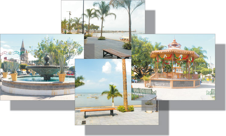
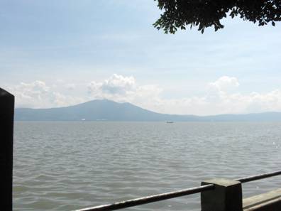 Resting in a tectonic basin south of Guadalajara, Lake Chapala is surrounded by quiet villages and volcanic hills. It is situated at an altitude of 1,525 meters (5,000 feet) in the southeastern part of the Sierra Madre Mountains, and is the largest lake in Mexico. Numerous towns and villages surround the central and western end of the lake: Ajijic, Atotonilquillo, San Antonio Tlayacapan, San Nicolas de Ibarra, Santa Cruz de la Soledad, San Juan Cosala, El Chante, Jocotepec, San Pedro Tesistan, San Cristóbal Zapotitlán, San Luis Soyotlán, and Tizapán el Alto